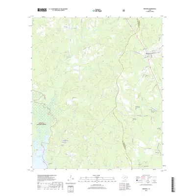
2019 Map of Bronson
USGS Topo · Published 2019About this map
Bronson stands as the primary settlement in this corner of East Texas, where the local economy and geography are defined by the convergence of the Angelina National Forest and the northern reaches of the Sam Rayburn Reservoir. The landscape is etched by a dense network of waterways including Chiamon Bayou, Tiger Cr, and Sandy Cr, which navigate the wooded terrain of both San Augustine and Sabine counties. This area is particularly rich in genealogical sites, preserved through numerous family burial grounds such as the Beauchamp Family Cem, McClelland Family Cem, and Whitton Family Cem. The presence of both the Centerview Cem and Old Centerview Cem suggests a shifting center of community life over time. Evidence of rural infrastructure is found in the scattered roads and timber-related routes like the Timberland Hwy, which cut through the piney woods toward the reservoir edge near Woods Cem.
Find a feature on this map
57 named features on this map. Tap any name to fly to it.
Don’t see what you’re looking for? This feature index may not catch every label — zoom into the map to look around manually.
Map Details
Editions of this 2019 Bronson Map
This is the sole edition of this map. No revisions or reprints were ever made.
Other maps of this area

1953 · Alexandria
USGS Topo · 1:250,000

1953 · Palestine
USGS Topo · 1:250,000

1955 · Alexandria
USGS Topo · 1:250,000

1957 · Palestine
USGS Topo · 1:250,000

1957 · Brookeland
USGS Topo · 1:62,500

1958 · Hemphill
USGS Topo · 1:62,500

1958 · Mc Gee Bend
USGS Topo · 1:62,500

1958 · Bronson
USGS Topo · 1:62,500

1969 · Brookeland
USGS Topo · 1:62,500

1984 · Norwood
USGS Topo · 1:24,000