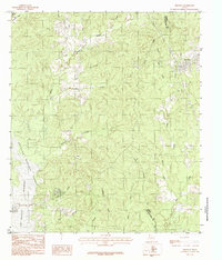
1984 Map of Bronson
USGS Topo · Published 1984About this map
Bronson stands at the northeastern edge of this East Texas survey, where the town grid transitions into a landscape defined by the drainage basins of the Angelina National Forest. The southwestern portion of the sheet is dominated by the sprawling reach of the Sam Rayburn Reservoir, with specific water levels noted at Normal Pool 164 A.S.L. 176. This intersection of managed timberland and man-made reservoir creates a distinct boundary between the settled areas and the conserved forest environment.
Find a feature on this map
22 named features on this map. Tap any name to fly to it.
Don’t see what you’re looking for? This feature index may not catch every label — zoom into the map to look around manually.
Map Details
Editions of this 1984 Bronson Map
This is the sole edition of this map. No revisions or reprints were ever made.
Other maps of this area

1953 · Alexandria
USGS Topo · 1:250,000

1953 · Palestine
USGS Topo · 1:250,000

1955 · Alexandria
USGS Topo · 1:250,000

1957 · Palestine
USGS Topo · 1:250,000

1957 · Brookeland
USGS Topo · 1:62,500

1958 · Hemphill
USGS Topo · 1:62,500

1958 · Mc Gee Bend
USGS Topo · 1:62,500

1958 · Bronson
USGS Topo · 1:62,500

1969 · Brookeland
USGS Topo · 1:62,500

1984 · Norwood
USGS Topo · 1:24,000