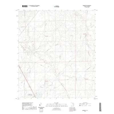
2021 Map of Bronson SW
USGS Topo · Published 2021About this map
The Gulf Hammock region of Levy County is defined by its complex network of swampy lowlands and coastal tributaries in this 2021 survey. The landscape is dominated by the winding paths of the Waccasassa River and the Wekiva River, which cut through the dense hammocks. A high density of local forest roads and historical tracks, such as Flowing Well Rd and Sawdust Pile Rd, suggest a long-standing history of timber harvesting and land management in the area. Managed lands are central to the geography here, with the Goethe State Forest Trl providing access into the eastern reaches of the quadrangle. Smaller water bodies like Magee Br and Mule Cr drain the interior, reflecting the wet, low-lying character of the Gulf coast hinterlands. The settlement at Gulf Hammock serves as the primary hub in a region largely defined by its natural hydrology and state-protected forest resources.
Find a feature on this map
76 named features on this map. Tap any name to fly to it.
Don’t see what you’re looking for? This feature index may not catch every label — zoom into the map to look around manually.
Map Details
Editions of this 2021 Bronson SW Map
This is the sole edition of this map. No revisions or reprints were ever made.
Other maps of this area

1954 · Chiefland
USGS Topo · 1:24,000

1954 · Otter Creek
USGS Topo · 1:24,000

1954 · Bronson
USGS Topo · 1:24,000

1954 · Bronson SW
USGS Topo · 1:24,000

1954 · Gainesville
USGS Topo · 1:250,000

1955 · Lebanon Station
USGS Topo · 1:24,000

1955 · Waccasassa Bay
USGS Topo · 1:24,000

1955 · Tidewater
USGS Topo · 1:24,000

1955 · Bronson NE
USGS Topo · 1:24,000

1955 · Bronson SE
USGS Topo · 1:24,000