
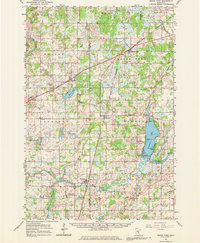
1961 Map of Brook Park
USGS Topo · Published 1963About this map
The Snake River winds across this Minnesota landscape, connecting a series of agricultural and railway settlements during the early 1960s. The Great Northern railroad serves as the primary corridor for commerce, linking the village of Brook Park with Quamba and Henriette. This transit line shaped the growth of the region, where gravel extraction and small-scale farming supported the local economy. Water features like the sprawling Pokegama Lake and its distinctive shoreline points, such as Tuxedo Bar and Clapps Bar, highlight the area's importance for local recreation.
Find a feature on this map
42 named features on this map. Tap any name to fly to it.
Don’t see what you’re looking for? This feature index may not catch every label — zoom into the map to look around manually.
Map Details
Editions of this 1961 Brook Park Map
2 editions found
Other maps of this area

1950 · Rush City
USGS Topo · 1:48,000

1953 · Duluth
USGS Topo · 1:250,000

1953 · Stillwater
USGS Topo · 1:250,000

1955 · Rush City
USGS Topo · 1:62,500

1955 · Stillwater
USGS Topo · 1:250,000

1958 · Stillwater
USGS Topo · 1:250,000

1958 · Duluth
USGS Topo · 1:250,000

1961 · Sandstone
USGS Topo · 1:62,500

1961 · Cambridge
USGS Topo · 1:62,500

1961 · Pine City
USGS Topo · 1:62,500