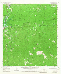
1957 Map of Brookeland
USGS Topo · Published 1967About this map
The Sabine National Forest dominates the landscape of East Texas in this mid-century survey, revealing a region defined by its timber and water resources. Settlements like Brookeland and Pineland are surrounded by a dense network of creeks, including Big Sandy Creek and Sixmile Creek, which have historically shaped the local geography and industry. A significant detail on this sheet is the blue hachured area indicating the proposed McGee Bend Reservoir, signaling the coming transformation of the Trout Bayou and Mc Kim Creek bottomlands into what is now Sam Rayburn Reservoir. Researchers can find several small, family-linked settlements such as Stumptown, Blackjack, and Browndell, along with numerous country burial grounds like Mc Elroy Cem and Spring Hill Cem. Cultural landmarks like Weeks Chapel and the Horton Lookout tower provide specific points of interest for local history and genealogical study in Newton, Sabine, and Jasper Counties.
Find a feature on this map
80 named features on this map. Tap any name to fly to it.
Don’t see what you’re looking for? This feature index may not catch every label — zoom into the map to look around manually.
Map Details
Editions of this 1957 Brookeland Map
2 editions found

Other maps of this area

1944 · Negreet
USGS Topo · 1:62,500

1944 · Wiergate
USGS Topo · 1:62,500

1948 · Wiergate
USGS Topo · 1:62,500

1952 · Lake Charles
USGS Topo · 1:250,000

1953 · Alexandria
USGS Topo · 1:250,000

1953 · Palestine
USGS Topo · 1:250,000

1954 · Wiergate
USGS Topo · 1:24,000

1954 · Columbus
USGS Topo · 1:24,000

1954 · Fairdale
USGS Topo · 1:24,000

1954 · Negreet
USGS Topo · 1:62,500