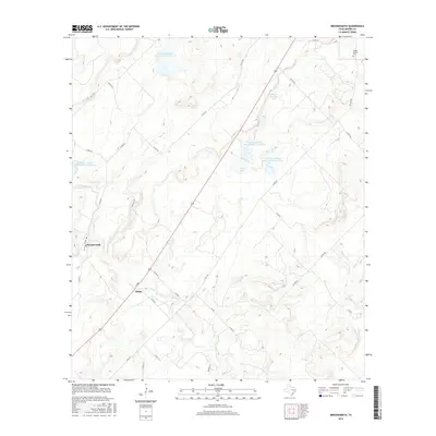
2016 Map of Brookesmith
USGS Topo · Published 2016About this map
Brookesmith and the nearby settlement of Dulin anchor this rural landscape in Brown County, defined by a series of mid-century water management projects. The terrain is marked by a network of drainage systems including W Fork Clear Cr and Clear Creek, feeding into several man-made impoundments such as Coggin Lake and Heald-Kennedy Lake. The presence of multiple Soil Conservation Service reservoirs, including Site 6 and Site 1, illustrates the region's managed hydraulic infrastructure. Local history is grounded at the Jordan Springs Cem in the northeast, while the road network of Farm to Market roads and county routes like FM 586 connects these small communities. The map reflects a modern pastoral environment where ranching and local transit paths follow the natural contours of the Central Texas creek valleys.
Find a feature on this map
34 named features on this map. Tap any name to fly to it.
Don’t see what you’re looking for? This feature index may not catch every label — zoom into the map to look around manually.
Map Details
Editions of this 2016 Brookesmith Map
This is the sole edition of this map. No revisions or reprints were ever made.
Other maps of this area

1885 · San Saba
USGS Topo · 1:125,000

1887 · Coleman
USGS Topo · 1:125,000

1889 · Brownwood
USGS Topo · 1:125,000

1889 · Coleman
USGS Topo · 1:125,000

1894 · Brady
USGS Topo · 1:125,000

1894 · Brownwood
USGS Topo · 1:125,000

1894 · San Saba
USGS Topo · 1:125,000

1925 · Brownwood 3-b
USGS Topo · 1:48,000

1925 · Brady 1-b
USGS Topo · 1:48,000

1925 · Brady 1-a
USGS Topo · 1:48,000