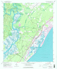
1943 Map of Brookgreen
USGS Topo · Published 1976About this map
Brookgreen Gardens anchors this coastal landscape, situated between the expansive rice-field heritage of the Waccamaw River and the salt marshes of the Atlantic. The intricate network of waterways like Bull Creek, Prince Creek, and Collins Creek illustrates the complex hydrologic character of the lowcountry, where timber and river commerce once thrived at sites like Longwood Landing and Wachesaw Landing. The transition from the river swamps to the coast is marked by a series of high-ground islands including Sandy Island and Richmond Island. Along the oceanfront, the development of Garden City Beach and the historic fishing village of Murrells Inlet show a mid-century shift toward coastal tourism. Inland, the map documents small rural communities served by Gordons Ch, Bethel Ch, and Brown Sch, reflecting the localized social geography of Georgetown County before modern highway expansion transformed the corridor.
Find a feature on this map
63 named features on this map. Tap any name to fly to it.
Don’t see what you’re looking for? This feature index may not catch every label — zoom into the map to look around manually.
Map Details
Editions of this 1943 Brookgreen Map
5 editions found
Other maps of this area

1937 · Myrtle Beach
USGS Topo · 1:48,000

1940 · Myrtle Beach
USGS Topo · 1:62,500

1942 · Magnolia Beach
USGS Topo · 1:24,000

1942 · Waverly Mills
USGS Topo · 1:24,000

1943 · Yauhannah
USGS Topo · 1:24,000

1943 · Bucksville
USGS Topo · 1:24,000

1943 · Brookgreen
USGS Topo · 1:24,000

1943 · Plantersville
USGS Topo · 1:24,000

1949 · Georgetown
USGS Topo · 1:250,000

1967 · Georgetown
USGS Topo · 1:250,000
Featured Places
- Garden City Beach, SC
- Murrells Inlet, SC
- Sunny Side, Murrells Inlet
- Prince Creek West, SC
- International Club, SC