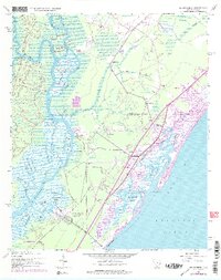
1943 Map of Brookgreen
USGS Topo · Published 1976About this map
Brookgreen Gardens and the winding reaches of the Waccamaw River define this South Carolina coastal landscape during the mid-twentieth century. The transition from the tidal river swamps of Sandy Island to the growing seaside community of Garden City Beach is documented in detail. The map highlights the early development of Murrells Inlet and the surrounding shoreline along Long Bay, where Main Creek and Woodland Creek snake through the salt marshes. Inland, the rural character of the era is preserved through numerous family and community landmarks, including St Peters Ch, St James Sch, and Collins Creek Ch. This survey illustrates the relationship between the historic river landings, such as Wachesaw Landing and Mulberry Landing, and the emerging coastal tourism economy that began to reshape the Lowcountry in the decades following the war.
Find a feature on this map
59 named features on this map. Tap any name to fly to it.
Don’t see what you’re looking for? This feature index may not catch every label — zoom into the map to look around manually.
Map Details
Editions of this 1943 Brookgreen Map
5 editions found
Other maps of this area

1937 · Myrtle Beach
USGS Topo · 1:48,000

1940 · Myrtle Beach
USGS Topo · 1:62,500

1942 · Magnolia Beach
USGS Topo · 1:24,000

1942 · Waverly Mills
USGS Topo · 1:24,000

1943 · Yauhannah
USGS Topo · 1:24,000

1943 · Bucksville
USGS Topo · 1:24,000

1943 · Brookgreen
USGS Topo · 1:24,000

1943 · Plantersville
USGS Topo · 1:24,000

1949 · Georgetown
USGS Topo · 1:250,000

1967 · Georgetown
USGS Topo · 1:250,000