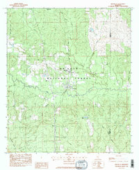
1983 Map of Brooklyn
USGS Topo · Published 1983About this map
The De Soto National Forest dominates this section of South Mississippi, where the winding course of Black Creek carves through the timberland. Settlement is concentrated along the Illinois Central Gulf Railroad corridor, which connects the small communities of Brooklyn, Rosine, and Currie. The map reveals a landscape defined by both conservation and extraction, as the southern border features the Maxie Gas Field and the central area includes the Forrest County Agricultural Sch. Significant for family historians, the sheet includes remote rural sites like Pleasant Hill Cem, Granny Bounds Cem, and Anderson Cem. Numerous water bodies, including Ashe Lake, Lake Janney, and Sportsmans Lake, suggest a terrain shaped by localized drainages and creek basins like Pearces Mill Creek and Granny Creek.
Find a feature on this map
36 named features on this map. Tap any name to fly to it.
Don’t see what you’re looking for? This feature index may not catch every label — zoom into the map to look around manually.
Map Details
Editions of this 1983 Brooklyn Map
2 editions found
Other maps of this area

1947 · Wiggins
USGS Topo · 1:62,500

1947 · New Augusta
USGS Topo · 1:62,500

1949 · Wiggins
USGS Topo · 1:62,500

1949 · New Augusta
USGS Topo · 1:62,500

1953 · Hattiesburg
USGS Topo · 1:250,000

1953 · Mobile
USGS Topo · 1:250,000

1957 · Mobile
USGS Topo · 1:250,000

1958 · Hattiesburg
USGS Topo · 1:250,000

1958 · Carnes
USGS Topo · 1:62,500

1960 · Mobile
USGS Topo · 1:250,000