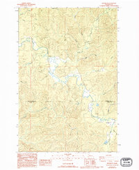
1986 Map of Brooklyn
USGS Topo · Published 1994About this map
The North River dominates this remote landscape at the edge of the Grays Harbor Co Pacific Co boundary during the mid-1980s. The settlement of Brooklyn sits near the confluence of the Godes River and the main channel, while the smaller community of Vesta is positioned to the north where Vesta Creek meets the river. This territory is defined by a dense network of drainage systems, including Salmon Cr, Leach Creek, and Tuttle Creek, which suggest a region heavily influenced by the logging and watershed management typical of the Pacific Northwest. A single Cem near Vesta and a Footbridge over the river near the northern edge of the sheet offer quiet evidence of the local infrastructure. The Pioneer Trail cuts through the eastern hills, highlighting the continued use of historic overland routes through the forested terrain.
Find a feature on this map
23 named features on this map. Tap any name to fly to it.
Don’t see what you’re looking for? This feature index may not catch every label — zoom into the map to look around manually.
Map Details
Editions of this 1986 Brooklyn Map
2 editions found
Other maps of this area

1940 · Montesano
USGS Topo · 1:62,500

1941 · Walville
USGS Topo · 1:62,500

1941 · Ford
USGS Topo · 1:62,500

1953 · Hoquiam
USGS Topo · 1:250,000

1953 · Pe Ell
USGS Topo · 1:62,500

1953 · Malone
USGS Topo · 1:62,500

1955 · Montesano
USGS Topo · 1:62,500

1955 · Raymond
USGS Topo · 1:62,500

1957 · Hoquiam
USGS Topo · 1:250,000

1958 · Hoquiam
USGS Topo · 1:250,000