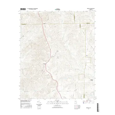
2017 Map of Brooklyn
USGS Topo · Published 2017About this map
Brooklyn and Renfroe anchor this rural landscape in Southwest Georgia, where the borders of Chattahoochee, Stewart, Marion, and Webster counties converge. The terrain is deeply defined by a drainage network feeding into Slaughter Cr and Little Slaughter Cr, with several family and community landmarks positioned along the ridgelines. Genealogists will find notable sites such as the Saint Phillip's Cem near the western edge and the Pickett-Shipley Cem to the east. The presence of Red Hill Church Rd and Mathis Store Rd suggests the historical locations of early community centers. Further south, the landscape opens toward Van Cleve Lake and Christmas Branch Lake, while the waters of Hannahatchee Cr and Bussey Br cut through the lower elevations, illustrating the essential relationship between the local geography and the rural road network that connects these small settlements.
Find a feature on this map
59 named features on this map. Tap any name to fly to it.
Don’t see what you’re looking for? This feature index may not catch every label — zoom into the map to look around manually.
Map Details
Editions of this 2017 Brooklyn Map
This is the sole edition of this map. No revisions or reprints were ever made.
Other maps of this area

1908 · Columbus
USGS Topo · 1:62,500

1929 · Columbus
USGS Topo · 1:48,000

1947 · Columbus
USGS Topo · 1:62,500

1949 · Glen Alta
USGS Topo · 1:24,000

1949 · Cusseta
USGS Topo · 1:24,000

1950 · Louvale
USGS Topo · 1:24,000

1950 · Buena Vista
USGS Topo · 1:24,000

1950 · Lumpkin
USGS Topo · 1:24,000

1950 · Buena Vista
USGS Topo · 1:62,500

1950 · Lumpkin
USGS Topo · 1:62,500