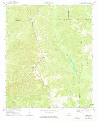
1973 Map of Brooklyn
USGS Topo · Published 1975About this map
The Seaboard Coast Line railroad serves as the central spine of this Georgia landscape, connecting the rural communities of Renfroe and Brooklyn. This 1973 survey reveals an economy and social structure defined by agricultural settlements and emerging industrial activity, notably the prominent Strip Mine operations and associated Tailings Ponds near the center of the sheet. The terrain is deeply carved by water, with Slaughter Creek and its tributary Little Slaughter Creek meandering toward the east, while Hannahatchee Creek and Chamblers Branch drain the southwestern reaches.
Find a feature on this map
30 named features on this map. Tap any name to fly to it.
Don’t see what you’re looking for? This feature index may not catch every label — zoom into the map to look around manually.
Map Details
Editions of this 1973 Brooklyn Map
This is the sole edition of this map. No revisions or reprints were ever made.
Other maps of this area

1908 · Columbus
USGS Topo · 1:62,500

1929 · Columbus
USGS Topo · 1:48,000

1947 · Columbus
USGS Topo · 1:62,500

1949 · Glen Alta
USGS Topo · 1:24,000

1949 · Cusseta
USGS Topo · 1:24,000

1950 · Louvale
USGS Topo · 1:24,000

1950 · Buena Vista
USGS Topo · 1:24,000

1950 · Lumpkin
USGS Topo · 1:24,000

1950 · Buena Vista
USGS Topo · 1:62,500

1950 · Lumpkin
USGS Topo · 1:62,500