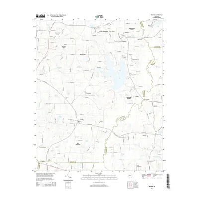
2014 Map of Brooks
USGS Topo · Published 2014About this map
Woolsey and Brooks serve as the primary hubs in this part of Georgia, where the headwaters of Whitewater Creek and numerous smaller lakes define the landscape. The area is marked by a legacy of family-owned lands and agricultural estates, evidenced by names like Stubbs Plantation, Gantt Acres, and Bakersfield Farms. The course of the Flint River forms a significant natural boundary, winding through the eastern portion of the map near Lowry and Vaughn.
Find a feature on this map
117 named features on this map. Tap any name to fly to it.
Don’t see what you’re looking for? This feature index may not catch every label — zoom into the map to look around manually.
Map Details
Editions of this 2014 Brooks Map
This is the sole edition of this map. No revisions or reprints were ever made.
Other maps of this area

1953 · Atlanta
USGS Topo · 1:250,000

1957 · Atlanta
USGS Topo · 1:250,000

1958 · Atlanta
USGS Topo · 1:250,000

1965 · Tyrone
USGS Topo · 1:24,000
1965 · Hampton
USGS Topo · 1:24,000

1965 · Fayetteville
USGS Topo · 1:24,000

1965 · Senoia
USGS Topo · 1:24,000

1965 · Griffin North
USGS Topo · 1:24,000

1965 · Brooks
USGS Topo · 1:24,000

1971 · Hollonville
USGS Topo · 1:24,000