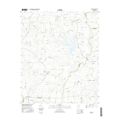
2017 Map of Brooks
USGS Topo · Published 2017About this map
Brooks serves as a central hub within this Fayette County landscape, where the town's grid meets several significant family and community landmarks. The area's genealogical history is well-preserved through numerous burial sites, ranging from the central Brooks City Cem and Brooks Memorial Gardens to smaller family plots like the John Bates Family Cem. To the north, the settlement of Woolsey sits near Dungan Lake, while the southeastern corner reaches toward Vaughn and Rio near the Heads Cr Reservoir.
Find a feature on this map
160 named features on this map. Tap any name to fly to it.
Don’t see what you’re looking for? This feature index may not catch every label — zoom into the map to look around manually.
Map Details
Editions of this 2017 Brooks Map
This is the sole edition of this map. No revisions or reprints were ever made.
Other maps of this area

1953 · Atlanta
USGS Topo · 1:250,000

1957 · Atlanta
USGS Topo · 1:250,000

1958 · Atlanta
USGS Topo · 1:250,000

1965 · Tyrone
USGS Topo · 1:24,000
1965 · Hampton
USGS Topo · 1:24,000

1965 · Fayetteville
USGS Topo · 1:24,000

1965 · Senoia
USGS Topo · 1:24,000

1965 · Griffin North
USGS Topo · 1:24,000

1965 · Brooks
USGS Topo · 1:24,000

1971 · Hollonville
USGS Topo · 1:24,000