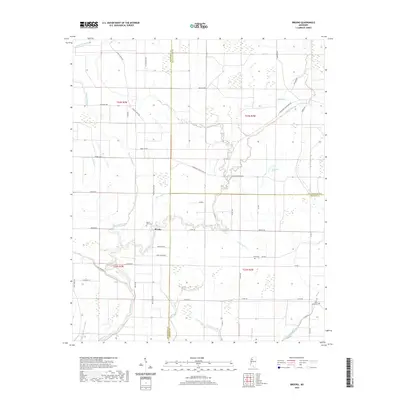
2020 Map of Brooks
USGS Topo · Published 2020About this map
Brooks sits at the heart of this alluvial landscape where the Quiver River and Fighting Bayou converge. This 2020 survey of the Mississippi Delta reveals a region defined by its complex network of waterways, including Wild Bill Bayou, Powell Bayou, and Parks Bayou. The intersection of Sunflower, Tallahatchie, and Leflore counties is marked by traditional land divisions and a grid of rural roads like Sturdivant White Rock Rd and Brooks Rd. Genealogical interest is anchored by local landmarks such as Mount Olive Cem, Scott Cem, and Saint Marys Cem. The landscape also features Wade School and distinctive natural features like Horseshoe Brake and Hoard Lake, illustrating the persistent relationship between the area's agricultural development and its native wetlands.
Find a feature on this map
53 named features on this map. Tap any name to fly to it.
Don’t see what you’re looking for? This feature index may not catch every label — zoom into the map to look around manually.
Map Details
Editions of this 2020 Brooks Map
This is the sole edition of this map. No revisions or reprints were ever made.
Other maps of this area

1931 · Schlater
USGS Topo · 1:48,000

1931 · Sumner
USGS Topo · 1:48,000

1931 · Drew
USGS Topo · 1:48,000

1934 · Cleveland
USGS Topo · 1:62,500

1934 · Schlater
USGS Topo · 1:62,500

1935 · Sumner
USGS Topo · 1:62,500

1935 · Mound Bayou
USGS Topo · 1:62,500

1939 · Schlater
USGS Topo · 1:62,500

1939 · Sumner
USGS Topo · 1:62,500

1940 · Cleveland
USGS Topo · 1:62,500