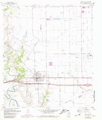
1971 Map of Brookshire
USGS Topo · Published 1980About this map
The Katy Gas and Oil Field dominates the eastern horizon of this survey, revealing the industrial landscape of Waller County during a period of transition. At the center, Brookshire serves as a critical junction for the Missouri Kansas Texas railroad, which parallels the main east-west highway through the region. The map captures a mix of established agricultural lands and growing infrastructure, featuring the Refinery and Air Rice Landing Strip near the Katy Gas and Oil Field.
Find a feature on this map
37 named features on this map. Tap any name to fly to it.
Don’t see what you’re looking for? This feature index may not catch every label — zoom into the map to look around manually.
Map Details
Editions of this 1971 Brookshire Map
2 editions found
Other maps of this area

1915 · Katy
USGS Topo · 1:24,000

1916 · Swanson
USGS Topo · 1:24,000

1919 · Swanson
USGS Topo · 1:31,680

1950 · Houston
USGS Topo · 1:250,000

1953 · Seguin
USGS Topo · 1:250,000

1955 · Brookshire
USGS Topo · 1:62,500

1955 · Richmond
USGS Topo · 1:62,500

1956 · Sealy
USGS Topo · 1:62,500

1956 · Wallis
USGS Topo · 1:62,500

1956 · Houston
USGS Topo · 1:250,000