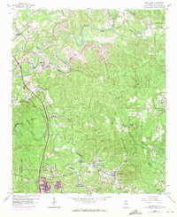
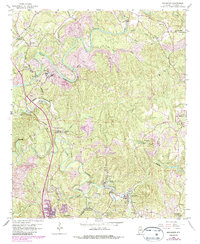
1959 Map of Brookside
USGS Topo · Published 1971About this map
The winding banks of the Locust Fork and Fivemile Creek reveal a landscape defined by Alabama's industrial past. This 1959 survey, updated in 1971, captures the extensive coal mining infrastructure north of Birmingham, including prominent Strip Mines and the U S Reservation Flat Top Experimental Forest. The region's geography is tightly linked to the Southern Railway and the Louisville and Nashville Railroad, which connected small industrial settlements like Brookside, Cardiff, and Sayre to the wider world.
Find a feature on this map
57 named features on this map. Tap any name to fly to it.
Don’t see what you’re looking for? This feature index may not catch every label — zoom into the map to look around manually.
Map Details
Editions of this 1959 Brookside Map
5 editions found
Other maps of this area

1889 · Birmingham
USGS Topo · 1:125,000

1892 · Birmingham
USGS Topo · 1:125,000

1893 · Jasper
USGS Topo · 1:125,000

1895 · Birmingham
USGS Topo · 1:125,000

1904 · Birmingham Coal District
USGS Topo · 1:62,500

1906 · Birmingham Special
USGS Topo · 1:62,500

1907 · Birmingham
USGS Topo · 1:125,000

1935 · Port Birmingham
USGS Topo · 1:48,000

1938 · Port Birmingham
USGS Topo · 1:62,500

1949 · Sipsey
USGS Topo · 1:24,000