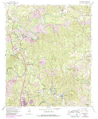
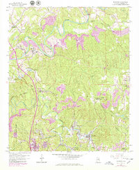
1959 Map of Brookside
USGS Topo · Published 1986About this map
Locust Fork winds through the heart of this North Alabama landscape, its deep bends framing an era of intense resource extraction and tight-knit mining communities. The map documents the extensive presence of the Strip Mine industry, which shaped the hills around Sayre and Crocker Mtn. This industrial activity is woven into a network of small settlements and crossings, including Robbins Crossroads and Linn Crossing. Genealogical researchers will find significant value in the distribution of rural landmarks, from the Old Caledonia Ch in the north to Lees Chapel and St Pauls Ch further south. The convergence of the Seaboard and Southern railroads underscores the importance of the rail-and-river economy in transporting materials from the regional coalfields to the industrial centers of Jefferson County.
Find a feature on this map
48 named features on this map. Tap any name to fly to it.
Don’t see what you’re looking for? This feature index may not catch every label — zoom into the map to look around manually.
Map Details
Editions of this 1959 Brookside Map
5 editions found
Other maps of this area

1889 · Birmingham
USGS Topo · 1:125,000

1892 · Birmingham
USGS Topo · 1:125,000

1893 · Jasper
USGS Topo · 1:125,000

1895 · Birmingham
USGS Topo · 1:125,000

1904 · Birmingham Coal District
USGS Topo · 1:62,500

1906 · Birmingham Special
USGS Topo · 1:62,500

1907 · Birmingham
USGS Topo · 1:125,000

1935 · Port Birmingham
USGS Topo · 1:48,000

1938 · Port Birmingham
USGS Topo · 1:62,500

1949 · Sipsey
USGS Topo · 1:24,000