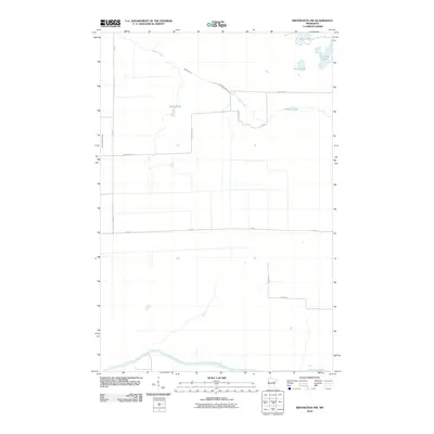
2010 Map of Brookston NW
USGS Topo · Published 2010About this map
The Saint Louis River snakes along the southern edge of this landscape, anchoring a network of wetlands and small glacial lakes in Saint Louis County. In the early 21st century, this region remained a low-density rural expanse defined by its hydrology, with Spider Creek cutting a long path from the northwest toward the center. The map reveals a pattern of section-line roads and named local routes such as Richardson Rd and Stenstrom Rd, which provide access to clusters of small water bodies like Spider Lake, Muskrat Lake, and Round Lake. The presence of Aerie Lake and Crooked Lake in the northeast corner further illustrates the water-rich nature of the North Woods, where the Little Whiteface River also makes a brief appearance on the western margin.
Find a feature on this map
16 named features on this map. Tap any name to fly to it.
Don’t see what you’re looking for? This feature index may not catch every label — zoom into the map to look around manually.
Map Details
Editions of this 2010 Brookston NW Map
This is the sole edition of this map. No revisions or reprints were ever made.
Other maps of this area

1953 · Payne
USGS Topo · 1:24,000

1953 · Alborn
USGS Topo · 1:24,000

1953 · Brookston
USGS Topo · 1:24,000

1953 · Brookston NW
USGS Topo · 1:24,000

1953 · Duluth
USGS Topo · 1:250,000

1954 · Martin Lake
USGS Topo · 1:24,000

1954 · Hibbing
USGS Topo · 1:250,000

1957 · Hibbing
USGS Topo · 1:250,000

1958 · Hibbing
USGS Topo · 1:250,000

1958 · Duluth
USGS Topo · 1:250,000