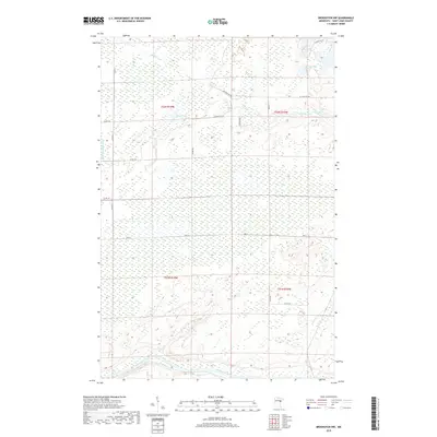
2019 Map of Brookston NW
USGS Topo · Published 2019About this map
The Saint Louis River snakes across the southern reaches of this landscape, marking a significant hydrological boundary within the northern woods of Minnesota. This 2019 survey captures a region defined by extensive wetlands and a complex network of tributaries, including the Little Whiteface River and the meandering Spider Cr. The terrain is punctuated by several glacial basins, most notably Spider Lake, Round Lake, and Muskrat Lake, which dot the northern half of the quadrangle.
Find a feature on this map
22 named features on this map. Tap any name to fly to it.
Don’t see what you’re looking for? This feature index may not catch every label — zoom into the map to look around manually.
Map Details
Editions of this 2019 Brookston NW Map
This is the sole edition of this map. No revisions or reprints were ever made.
Other maps of this area

1953 · Payne
USGS Topo · 1:24,000

1953 · Alborn
USGS Topo · 1:24,000

1953 · Brookston
USGS Topo · 1:24,000

1953 · Brookston NW
USGS Topo · 1:24,000

1953 · Duluth
USGS Topo · 1:250,000

1954 · Martin Lake
USGS Topo · 1:24,000

1954 · Hibbing
USGS Topo · 1:250,000

1957 · Hibbing
USGS Topo · 1:250,000

1958 · Hibbing
USGS Topo · 1:250,000

1958 · Duluth
USGS Topo · 1:250,000