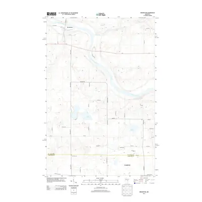
2013 Map of Brookston
USGS Topo · Published 2013About this map
Brookston sits at the confluence of the Saint Louis River and Stoney Brook, serving as a central point of settlement in this northern landscape. The terrain is defined by the winding paths of the Saint Louis and Cloquet River, which carve through the region near Bear Claw Pass. Towards the south, the boundary between St. Louis and Carlton counties divides the map, where the northern reaches of Cloquet appear. Local history and genealogy are anchored by landmarks like Brevator Cem and Birch Lake Cem, while the interior is dotted with significant water bodies including Twin Lakes and Simian Lake. An extensive network of rural roads such as Brookston Rd, Brevator Rd, and Mahnomen Rd connects scattered residences and provides a clear view of the area's development patterns along the river valleys.
Find a feature on this map
42 named features on this map. Tap any name to fly to it.
Don’t see what you’re looking for? This feature index may not catch every label — zoom into the map to look around manually.
Map Details
Editions of this 2013 Brookston Map
This is the sole edition of this map. No revisions or reprints were ever made.
Other maps of this area

1953 · Saginaw
USGS Topo · 1:24,000

1953 · Alborn
USGS Topo · 1:24,000

1953 · Brookston
USGS Topo · 1:24,000

1953 · Independence
USGS Topo · 1:24,000

1953 · Brookston NW
USGS Topo · 1:24,000

1953 · Duluth
USGS Topo · 1:250,000

1954 · Cloquet
USGS Topo · 1:24,000

1954 · Iverson
USGS Topo · 1:24,000

1954 · Sawyer
USGS Topo · 1:24,000

1954 · Martin Lake
USGS Topo · 1:24,000