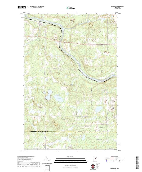
2022 Map of Brookston
USGS Topo · Published 2022About this map
The Saint Louis River and Cloquet River converge in the northern portion of this landscape, marking a significant hydrologic junction near the settlement of Brookston. This area of northern Minnesota is defined by extensive wetlands and scattered glacial lakes, including Twin Lakes and Simian Lake, which dominate the central and eastern sections. To the south, the community of Mahnomen sits near the county line, where local history is recorded at sites like Brevator Cem and Birch Lake Cem. The road network, including Co Hwy 80 and Brookston Rd, connects these small settlements through a terrain of numerous small bogs and watercourses like Stony Brook and Martin Br. The southern edge of the map transitions into the northern reaches of the Cloquet area, reflecting the quiet, rural character of the region as it appeared in the early 21st century.
Find a feature on this map
58 named features on this map. Tap any name to fly to it.
Don’t see what you’re looking for? This feature index may not catch every label — zoom into the map to look around manually.
Map Details
Editions of this 2022 Brookston Map
This is the sole edition of this map. No revisions or reprints were ever made.
Other maps of this area

1953 · Saginaw
USGS Topo · 1:24,000

1953 · Alborn
USGS Topo · 1:24,000

1953 · Brookston
USGS Topo · 1:24,000

1953 · Independence
USGS Topo · 1:24,000

1953 · Brookston NW
USGS Topo · 1:24,000

1953 · Duluth
USGS Topo · 1:250,000

1954 · Cloquet
USGS Topo · 1:24,000

1954 · Iverson
USGS Topo · 1:24,000

1954 · Sawyer
USGS Topo · 1:24,000

1954 · Martin Lake
USGS Topo · 1:24,000