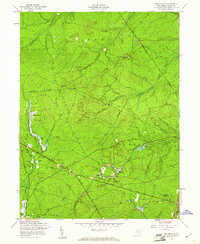
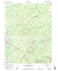
1957 Map of Brookville
USGS Topo · Published 1961About this map
The coastal pine forests and wetlands of Ocean County define this landscape during the mid-century period of development. Small settlements like Brookville and Howardsville appear alongside extensive water management features, including several Cranberry Bogs and the Wells Mill Reservoir. The expansion of regional infrastructure is evident in the path of the Garden State Parkway, which cuts through the southwestern corner near Warren Grove.
Find a feature on this map
35 named features on this map. Tap any name to fly to it.
Don’t see what you’re looking for? This feature index may not catch every label — zoom into the map to look around manually.
Map Details
Editions of this 1957 Brookville Map
5 editions found
Other maps of this area

1884 · Whitings
USGS Topo · 1:62,500

1888 · Barnegat
USGS Topo · 1:62,500

1888 · Little Egg Harbor
USGS Topo · 1:62,500

1888 · Long Beach
USGS Topo · 1:62,500

1888 · Whitings
USGS Topo · 1:62,500

1893 · Little Egg Harbor
USGS Topo · 1:62,500

1893 · Long Beach
USGS Topo · 1:62,500

1893 · Barnegat
USGS Topo · 1:62,500

1898 · Barnegat
USGS Topo · 1:62,500

1919 · Long Beach
USGS Topo · 1:62,500