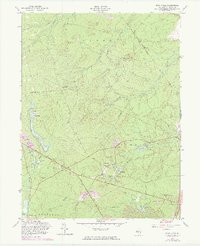
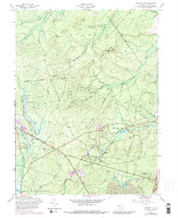
1957 Map of Brookville
USGS Topo · Published 1973About this map
Brookville and its surrounding wetlands define this portion of Ocean County during the mid-twentieth century, characterized by an extensive network of Cranberry Bogs and narrow waterways. The landscape is shaped by the drainage of the Oyster Creek and the North Branch Forked River, which flow through the pine-dominated terrain. Small, isolated settlements like Howardsville and Reevestown appear alongside the Reevestown Cem, reflecting the area's rural history.
Find a feature on this map
35 named features on this map. Tap any name to fly to it.
Don’t see what you’re looking for? This feature index may not catch every label — zoom into the map to look around manually.
Map Details
Editions of this 1957 Brookville Map
5 editions found
Other maps of this area

1884 · Whitings
USGS Topo · 1:62,500

1888 · Barnegat
USGS Topo · 1:62,500

1888 · Little Egg Harbor
USGS Topo · 1:62,500

1888 · Long Beach
USGS Topo · 1:62,500

1888 · Whitings
USGS Topo · 1:62,500

1893 · Little Egg Harbor
USGS Topo · 1:62,500

1893 · Long Beach
USGS Topo · 1:62,500

1893 · Barnegat
USGS Topo · 1:62,500

1898 · Barnegat
USGS Topo · 1:62,500

1919 · Long Beach
USGS Topo · 1:62,500