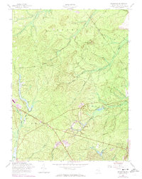
1957 Map of Brookville
USGS Topo · Published 1973About this map
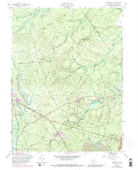
The New Jersey Pine Barrens are revealed in detail through this mid-century survey of the Brookville and Howardsville areas. The landscape is defined by its extensive wetlands and agricultural heritage, most notably the numerous Cranberry Bogs along the Oswego River and Trailer Creek. This era of documentation shows the early footprint of the Garden State Parkway cutting through the forest, contrasting with older terrestrial marks like the Railroad Grade and the historic Barnegat Road. Local life is centered around small clearings such as Warren Grove, while recreation is represented by the North Sportsman Club and various gun clubs. The presence of the Reevestown Cem provides a genealogical touchpoint for families of the southern New Jersey interior. Significant water features like the Wells Mills Reservoir and Oyster Creek drain the terrain toward the coast, illustrating the hydrologic character of the Ocean and Union township borders.
Find a feature on this map
30 named features on this map. Tap any name to fly to it.
Don’t see what you’re looking for? This feature index may not catch every label — zoom into the map to look around manually.
Map Details
Editions of this 1957 Brookville Map
5 editions found
Other maps of this area

1884 · Whitings
USGS Topo · 1:62,500

1888 · Barnegat
USGS Topo · 1:62,500

1888 · Little Egg Harbor
USGS Topo · 1:62,500

1888 · Long Beach
USGS Topo · 1:62,500

1888 · Whitings
USGS Topo · 1:62,500

1893 · Little Egg Harbor
USGS Topo · 1:62,500

1893 · Long Beach
USGS Topo · 1:62,500

1893 · Barnegat
USGS Topo · 1:62,500

1898 · Barnegat
USGS Topo · 1:62,500

1919 · Long Beach
USGS Topo · 1:62,500