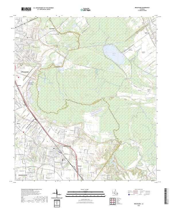
2024 Map of Broussard
USGS Topo · Published 2024About this map
Broussard and its neighboring communities of Billeaud and Youngsville anchor the southern reaches of this landscape, showing a dense network of suburban expansion and industrial transport corridors. The map details the transition from the city of Lafayette toward the eastern bayous and wetlands, including the expansive Jean Lafitte National Historical Park and Preserve. Genealogists will find significant value in the numerous recorded burial sites across the parishes, such as Sacred Heart Catholic Cem, Saint Joseph Cem, and Progressive Baptist Cem.
Find a feature on this map
182 named features on this map. Tap any name to fly to it.
Don’t see what you’re looking for? This feature index may not catch every label — zoom into the map to look around manually.
Map Details
Editions of this 2024 Broussard Map
This is the sole edition of this map. No revisions or reprints were ever made.
Other maps of this area

1939 · St. Martinsville
USGS Topo · 1:62,500

1940 · Arnaudville
USGS Topo · 1:62,500

1946 · Milton
USGS Topo · 1:31,680

1946 · Lafayette
USGS Topo · 1:31,680

1952 · Lake Charles
USGS Topo · 1:250,000

1954 · Lafayette
USGS Topo · 1:31,680
1954 · Milton
USGS Topo · 1:31,680

1954 · Lake Charles
USGS Topo · 1:250,000

1954 · Baton Rouge
USGS Topo · 1:250,000

1955 · Lafayette
USGS Topo · 1:24,000