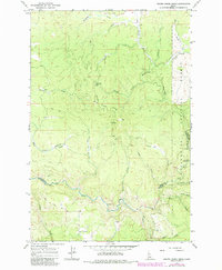
1966 Map of Brown Creek Ridge
USGS Topo · Published 1984About this map
Brown Creek Ridge dominates this portion of the Clearwater National Forest along the border of Clearwater and Idaho counties. The landscape is defined by an intricate drainage system feeding into the Lolo Creek and the Clearwater River, where specific points like Mile 18 and Mile 20 mark the waterway's course. Historically significant for its accessibility and forestry management, the area features the Brown Creek Lookout and a network of Jeep Trails that provided access to timber and recreation sites such as Pheasant Camp and the Lolo Creek Campground. The naming of smaller tributaries like Pete and Charlie Creek and Jim Brown Creek suggests a history of local habitation or early exploration in these woods. The presence of a Gravel Pit near Deer Gulch indicates local resource extraction used for the maintenance of the forest's rugged road network.
Find a feature on this map
37 named features on this map. Tap any name to fly to it.
Don’t see what you’re looking for? This feature index may not catch every label — zoom into the map to look around manually.
Map Details
Editions of this 1966 Brown Creek Ridge Map
2 editions found
Other maps of this area

1924 · Weippe
USGS Topo · 1:125,000

1956 · Hamilton
USGS Topo · 1:250,000

1959 · Hamilton
USGS Topo · 1:250,000

1960 · Hamilton
USGS Topo · 1:250,000

1964 · Hamilton
USGS Topo · 1:250,000

1966 · Kooskia
USGS Topo · 1:24,000

1966 · Pierce
USGS Topo · 1:24,000
1966 · Glenwood
USGS Topo · 1:24,000
1966 · Hemlock Butte
USGS Topo · 1:24,000
1966 · Brown Creek Ridge
USGS Topo · 1:24,000