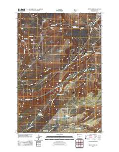
2011 Map of Brown Creek
USGS Topo · Published 2011About this map
Wasco Butte and the surrounding high flats of Wasco County define this landscape of water management and varied terrain. In the early 21st century, the region's reliance on managed water sources is evident through features like Wicks Reservoir, Trigg Reservoir, and the Liechti Pond system. The map reveals a transition from the structured grazing of the Thousand Acre Pasture to the dramatic relief of Blackburn Canyon and Indian Hollow. For those tracing local history or family heritage, the Obrist Cemetery near the southern border serves as a significant genealogical landmark. Small aviation sites like Chenoweth Airpark and Pointers Airfield highlight the modern rural infrastructure, while the drainage of Mill Creek and its associated Mill Creek Falls provides a natural framework for the eastern half of the quadrangle.
Find a feature on this map
59 named features on this map. Tap any name to fly to it.
Don’t see what you’re looking for? This feature index may not catch every label — zoom into the map to look around manually.
Map Details
Editions of this 2011 Brown Creek Map
This is the sole edition of this map. No revisions or reprints were ever made.
Other maps of this area

1930 · Dufur
USGS Topo · 1:125,000

1934 · Dufur
USGS Topo · 1:125,000

1934 · The Dalles
USGS Topo · 1:125,000

1953 · The Dalles
USGS Topo · 1:250,000

1956 · The Dalles
USGS Topo · 1:250,000

1957 · The Dalles
USGS Topo · 1:250,000

1957 · The Dalles
USGS Topo · 1:62,500

1957 · White Salmon
USGS Topo · 1:62,500

1962 · Wolf Run
USGS Topo · 1:24,000
1962 · Fivemile Butte
USGS Topo · 1:24,000