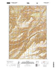
2020 Map of Brown Creek
USGS Topo · Published 2020About this map
Wasco Butte overlooks a high-altitude landscape defined by livestock pastures and aviation outposts within the Mount Hood National Forest. The eastern portion of the quadrangle shows a concentrated network of mountain infrastructure, including Chenoweth Airpark and Pointers Airport. The naming conventions here often hint at family lineages and early land use, seen in the Obrist Cem and the nearby Obrist Grade, alongside Indian Hollow and Thousand Acre Pasture.
Find a feature on this map
76 named features on this map. Tap any name to fly to it.
Don’t see what you’re looking for? This feature index may not catch every label — zoom into the map to look around manually.
Map Details
Editions of this 2020 Brown Creek Map
This is the sole edition of this map. No revisions or reprints were ever made.
Other maps of this area

1930 · Dufur
USGS Topo · 1:125,000

1934 · Dufur
USGS Topo · 1:125,000

1934 · The Dalles
USGS Topo · 1:125,000

1953 · The Dalles
USGS Topo · 1:250,000

1956 · The Dalles
USGS Topo · 1:250,000

1957 · The Dalles
USGS Topo · 1:250,000

1957 · The Dalles
USGS Topo · 1:62,500

1957 · White Salmon
USGS Topo · 1:62,500

1962 · Wolf Run
USGS Topo · 1:24,000
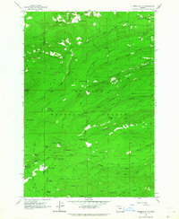
1962 · Fivemile Butte
USGS Topo · 1:24,000