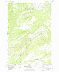
1974 Map of Brown Creek
USGS Topo · Published 1977About this map
Government Flat and Thousand Acre Pasture define the high plateau landscape of this portion of Wasco County during the mid-1970s. The map illustrates a transition from the forested heights of the Mount Hood National Forest boundary to the industrial and agricultural fringes of the Columbia River gorge. Civic and utility infrastructure is prominent, including the Grange Hall and the Chenoweth Air Park, alongside significant water management features like Wicks Reservoir and its associated Filtration Plant. This era shows a landscape being actively shaped by mid-century engineering, evidenced by the Gaging Station on Brown Creek and the Radio Facility near the Lookout Tower on Vensel Butte. Local history is preserved in the location of Indian Hollow and a local Cem near Threemile Creek, while the presence of Suicide Grade suggests the challenging topography of the region's early road network.
Find a feature on this map
66 named features on this map. Tap any name to fly to it.
Don’t see what you’re looking for? This feature index may not catch every label — zoom into the map to look around manually.
Map Details
Editions of this 1974 Brown Creek Map
This is the sole edition of this map. No revisions or reprints were ever made.
Other maps of this area

1930 · Dufur
USGS Topo · 1:125,000

1934 · Dufur
USGS Topo · 1:125,000

1934 · The Dalles
USGS Topo · 1:125,000

1953 · The Dalles
USGS Topo · 1:250,000

1956 · The Dalles
USGS Topo · 1:250,000

1957 · The Dalles
USGS Topo · 1:250,000
1957 · The Dalles
USGS Topo · 1:62,500
1957 · White Salmon
USGS Topo · 1:62,500
1962 · Wolf Run
USGS Topo · 1:24,000
1962 · Fivemile Butte
USGS Topo · 1:24,000