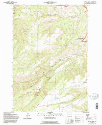
1994 Map of Brown Creek
USGS Topo · Published 1996About this map
Thousand Acre Pasture and the expansive plateaus of Government Flat define the high terrain south of the Columbia River Gorge in this mid-1990s survey. The landscape transitions from the rugged drainage of Lucky Canyon and Ladore Creek in the west toward the agricultural and residential fringes of The Dalles. Water management infrastructure is a prominent theme, evidenced by the The Dalles Watershed Management Unit, Wicks Reservoir, and a series of specialized facilities including a Filtration Plant and Gaging Station.
Find a feature on this map
97 named features on this map. Tap any name to fly to it.
Don’t see what you’re looking for? This feature index may not catch every label — zoom into the map to look around manually.
Map Details
Editions of this 1994 Brown Creek Map
This is the sole edition of this map. No revisions or reprints were ever made.
Other maps of this area

1930 · Dufur
USGS Topo · 1:125,000

1934 · Dufur
USGS Topo · 1:125,000

1934 · The Dalles
USGS Topo · 1:125,000

1953 · The Dalles
USGS Topo · 1:250,000

1956 · The Dalles
USGS Topo · 1:250,000

1957 · The Dalles
USGS Topo · 1:250,000

1957 · The Dalles
USGS Topo · 1:62,500

1957 · White Salmon
USGS Topo · 1:62,500

1962 · Wolf Run
USGS Topo · 1:24,000
1962 · Fivemile Butte
USGS Topo · 1:24,000