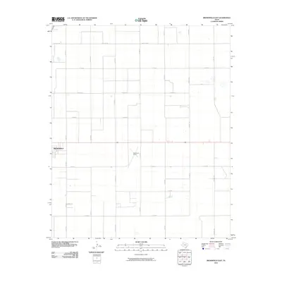
2010 Map of Brownfield East
USGS Topo · Published 2010About this map
Brownfield occupies the western edge of this High Plains landscape, where the town's expansion meets a vast agricultural grid. The map reveals a highly structured environment defined by section lines and an extensive network of rural routes, including Ranch Rd 1698 and Farm Rd 168. These roads facilitate the transport of crops across Terry County's flat, productive terrain. Central to the area's local infrastructure is the Terry County Airport, which sits alongside Co Rd 545. The land is dotted with family-named landmarks and local roads like David Bailey and Pecan Dr, reflecting the rural character and the importance of specific properties in this Texas ranching and farming community. A private Country Club provides a recreational contrast to the industrial and agricultural focus of the surrounding plains.
Find a feature on this map
21 named features on this map. Tap any name to fly to it.
Don’t see what you’re looking for? This feature index may not catch every label — zoom into the map to look around manually.
Map Details
Editions of this 2010 Brownfield East Map
This is the sole edition of this map. No revisions or reprints were ever made.
Other maps of this area

1954 · Brownfield
USGS Topo · 1:250,000

1957 · Meadow
USGS Topo · 1:62,500

1958 · Brownfield
USGS Topo · 1:250,000

1962 · Brownfield
USGS Topo · 1:250,000

1969 · Brownfield East
USGS Topo · 1:24,000

1969 · Foster
USGS Topo · 1:24,000

1969 · Sundown SE
USGS Topo · 1:24,000

1969 · Mound Lake
USGS Topo · 1:24,000

1969 · New Moore
USGS Topo · 1:24,000
1969 · Union School
USGS Topo · 1:24,000