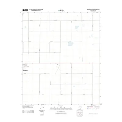
2012 Map of Brownfield East
USGS Topo · Published 2012About this map
Brownfield anchors the western edge of this High Plains landscape, where the town's residential streets transition abruptly into the highly structured agricultural grid of Terry County. The 2012 survey shows the eastern extent of the settlement, including named corridors like E Main St and Webb St. Central to the map is the Terry County Airport, its distinct runway layout positioned amidst a network of county roads. The terrain is characterized by numerous small, intermittent water features and depressions scattered across the plains between Ranch Road 1698 and Co Rd-470. Notable local landmarks like David Bailey and the Country Club Rd segment provide specific points of reference for genealogists and local historians tracing property and road developments in this part of West Texas.
Find a feature on this map
27 named features on this map. Tap any name to fly to it.
Don’t see what you’re looking for? This feature index may not catch every label — zoom into the map to look around manually.
Map Details
Editions of this 2012 Brownfield East Map
This is the sole edition of this map. No revisions or reprints were ever made.
Other maps of this area

1954 · Brownfield
USGS Topo · 1:250,000

1957 · Meadow
USGS Topo · 1:62,500

1958 · Brownfield
USGS Topo · 1:250,000

1962 · Brownfield
USGS Topo · 1:250,000

1969 · Brownfield East
USGS Topo · 1:24,000

1969 · Foster
USGS Topo · 1:24,000

1969 · Sundown SE
USGS Topo · 1:24,000

1969 · Mound Lake
USGS Topo · 1:24,000

1969 · New Moore
USGS Topo · 1:24,000
1969 · Union School
USGS Topo · 1:24,000