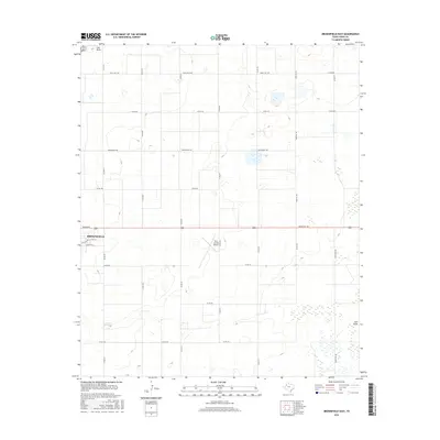
2016 Map of Brownfield East
USGS Topo · Published 2016About this map
Brownfield anchors the western edge of this High Plains landscape, where the town's residential streets like E Tate St and E Reppto St give way to an expansive grid of agricultural and ranch roads. The terrain is defined by subtle depressions and the intermittent drainage of Lost Draw, which meanders across the northern and southeastern corners of the quadrangle. Transportation is central to the area's layout, with the Terry County Airport situated east of the main settlement and major thoroughfares such as Tahoka Rd and Farm Rd 168 providing regional connectivity. The map reflects a classic West Texas pattern of land use, where the rigid geometry of roads like David Bailey Rd and Ranch Rd 1698 carves the vast, level topography into large-scale parcels typical of the region's ranching and farming heritage.
Find a feature on this map
25 named features on this map. Tap any name to fly to it.
Don’t see what you’re looking for? This feature index may not catch every label — zoom into the map to look around manually.
Map Details
Editions of this 2016 Brownfield East Map
This is the sole edition of this map. No revisions or reprints were ever made.
Other maps of this area

1954 · Brownfield
USGS Topo · 1:250,000

1957 · Meadow
USGS Topo · 1:62,500

1958 · Brownfield
USGS Topo · 1:250,000

1962 · Brownfield
USGS Topo · 1:250,000

1969 · Brownfield East
USGS Topo · 1:24,000

1969 · Foster
USGS Topo · 1:24,000

1969 · Sundown SE
USGS Topo · 1:24,000

1969 · Mound Lake
USGS Topo · 1:24,000

1969 · New Moore
USGS Topo · 1:24,000
1969 · Union School
USGS Topo · 1:24,000