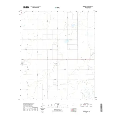
2019 Map of Brownfield East
USGS Topo · Published 2019About this map
Brownfield anchors the western edge of this High Plains landscape, where the town grid meets a vast agricultural and aviation corridor in Terry County. Central to the area is the Terry County Airport, its distinct runways positioned near the geographic center of the quadrangle. The terrain is defined by the natural course of Lost Draw, which meanders across the lower half of the map, carving a subtle depression through the surrounding ranchlands and cotton fields. A precise network of rural routes, including Ranch Rd 1698 and David Bailey Rd, reveals the organized settlement patterns of the Texas Panhandle. Residential extensions like Pecan Dr and Gillham Dr push out from the city center, illustrating the modern growth of this agricultural hub.
Find a feature on this map
25 named features on this map. Tap any name to fly to it.
Don’t see what you’re looking for? This feature index may not catch every label — zoom into the map to look around manually.
Map Details
Editions of this 2019 Brownfield East Map
This is the sole edition of this map. No revisions or reprints were ever made.
Other maps of this area

1954 · Brownfield
USGS Topo · 1:250,000

1957 · Meadow
USGS Topo · 1:62,500

1958 · Brownfield
USGS Topo · 1:250,000

1962 · Brownfield
USGS Topo · 1:250,000

1969 · Brownfield East
USGS Topo · 1:24,000

1969 · Foster
USGS Topo · 1:24,000

1969 · Sundown SE
USGS Topo · 1:24,000

1969 · Mound Lake
USGS Topo · 1:24,000

1969 · New Moore
USGS Topo · 1:24,000
1969 · Union School
USGS Topo · 1:24,000