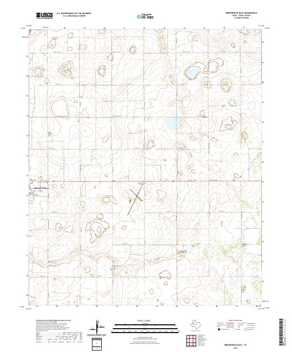
2022 Map of Brownfield East
USGS Topo · Published 2022About this map
Brownfield anchors the southwestern portion of this West Texas landscape, showing the city's eastward expansion during the early 2020s. The terrain is defined by the ephemeral passage of Lost Draw, which meanders through the southern half of the quadrangle amidst a grid of rural section roads. This topographic study captures the high plains character of Terry County, where the infrastructure of local aviation at Terry County Airport and the regional connectivity of Tahoka Rd meet the vast agricultural and ranching acreage of the Llano Estacado. Local family-named thoroughfares such as David Bailey Rd and essential connectors like Ranch Rd 1698 delineate the property boundaries and transport routes that have sustained this community's economy for generations.
Find a feature on this map
15 named features on this map. Tap any name to fly to it.
Don’t see what you’re looking for? This feature index may not catch every label — zoom into the map to look around manually.
Map Details
Editions of this 2022 Brownfield East Map
This is the sole edition of this map. No revisions or reprints were ever made.
Other maps of this area

1954 · Brownfield
USGS Topo · 1:250,000

1957 · Meadow
USGS Topo · 1:62,500

1958 · Brownfield
USGS Topo · 1:250,000

1962 · Brownfield
USGS Topo · 1:250,000

1969 · Brownfield East
USGS Topo · 1:24,000

1969 · Foster
USGS Topo · 1:24,000

1969 · Sundown SE
USGS Topo · 1:24,000

1969 · Mound Lake
USGS Topo · 1:24,000

1969 · New Moore
USGS Topo · 1:24,000
1969 · Union School
USGS Topo · 1:24,000