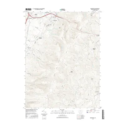
2016 Map of Brownfield
USGS Topo · Published 2016About this map
Wharton Furnace and Oliphant Furnace serve as physical reminders of the industrial heritage that once defined this portion of the Chestnut Ridge. The landscape is characterized by a series of deep hollows, including Askon Hollow and Cave Hollow, which dictate the placement of roads and early settlements. The presence of several historic burial sites, such as Little White Rock Cem and Brown Cem, offers valuable points of reference for genealogists studying the families of Fayette County.
Find a feature on this map
90 named features on this map. Tap any name to fly to it.
Don’t see what you’re looking for? This feature index may not catch every label — zoom into the map to look around manually.
Map Details
Editions of this 2016 Brownfield Map
This is the sole edition of this map. No revisions or reprints were ever made.
Other maps of this area

1900 · Uniontown
USGS Topo · 1:62,500

1900 · Masontown
USGS Topo · 1:62,500

1902 · Morgantown
USGS Topo · 1:62,500

1903 · Masontown
USGS Topo · 1:62,500

1904 · Bruceton
USGS Topo · 1:62,500

1925 · Morgantown
USGS Topo · 1:62,500

1926 · Bruceton
USGS Topo · 1:62,500

1931 · Uniontown
USGS Topo · 1:62,500

1931 · Masontown
USGS Topo · 1:62,500

1931 · Bruceton Mills
USGS Topo · 1:62,500
Featured Places
- North Union Township, PA
- Georges Township, PA
- Wharton Township, PA
- South Union Township, PA
- Point Breeze, Wharton Township