
1966 Map of Browns Mountain
USGS Topo · Published 1969About this map
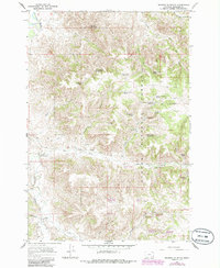
Bones Ranch and Daniels Ranch occupy the high plains of Rosebud County in the mid-1960s, a landscape defined by cattle ranching and rugged water management. The terrain is deeply incised by drainages such as Hanging Woman Creek and Hackley Creek, which flow toward the Tongue River in the northwest corner. Much of the eastern portion of the sheet is protected within the Custer National Forest, where a network of springs and man-made catchments like Timber Creek Basin Reservoir and Poker Jim Reservoir No 2 support livestock and wildlife.
Find a feature on this map
43 named features on this map. Tap any name to fly to it.
Don’t see what you’re looking for? This feature index may not catch every label — zoom into the map to look around manually.
Map Details
Editions of this 1966 Browns Mountain Map
2 editions found
Other maps of this area

1954 · Hardin
USGS Topo · 1:250,000

1957 · Hardin
USGS Topo · 1:250,000

1958 · Hardin
USGS Topo · 1:250,000

1966 · Birney Day School
USGS Topo · 1:24,000

1966 · Poker Jim Butte
USGS Topo · 1:24,000
1966 · Green Creek
USGS Topo · 1:24,000

1967 · Clubfoot Creek
USGS Topo · 1:24,000

1967 · Birney
USGS Topo · 1:24,000

1967 · Lacey Gulch
USGS Topo · 1:24,000
1972 · Stroud Creek
USGS Topo · 1:24,000