
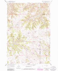
1966 Map of Poker Jim Butte
USGS Topo · Published 1969About this map
Custer National Forest encompasses this high-country landscape along the divide between Rosebud and Powder River counties. The area is defined by a series of prominent high points, including Wild Hog Butte and Poker Jim Butte, which is topped by a lookout tower and offers a vantage point over the complex drainage systems below. The land management and agricultural history of the mid-20th century are evident through features like the Experimental Pasture Reservoir and the Jackson Sawmill Spring, suggesting a landscape utilized for both timber and range research.
Find a feature on this map
46 named features on this map. Tap any name to fly to it.
Don’t see what you’re looking for? This feature index may not catch every label — zoom into the map to look around manually.
Map Details
Editions of this 1966 Poker Jim Butte Map
2 editions found
Other maps of this area

1954 · Hardin
USGS Topo · 1:250,000

1957 · Hardin
USGS Topo · 1:250,000

1958 · Hardin
USGS Topo · 1:250,000

1966 · Browns Mountain
USGS Topo · 1:24,000

1966 · Birney Day School
USGS Topo · 1:24,000

1966 · Fort Howes
USGS Topo · 1:24,000

1966 · King Mountain
USGS Topo · 1:24,000
1966 · Green Creek
USGS Topo · 1:24,000
1972 · Stroud Creek
USGS Topo · 1:24,000
1972 · Hamilton Draw
USGS Topo · 1:24,000