
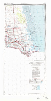
1956 Map of Brownsville
USGS Topo · Published 1969About this map
The southern tip of Texas and the borderlands of the lower Rio Grande define this mid-century landscape. Centered on the growing agricultural and transit hubs of Harlingen and Brownsville, the map shows a region heavily shaped by water management and maritime trade. The Brownsville Ship Channel and the Intracoastal Waterway cut through the coastal lagoons, connecting inland ports to the Gulf of Mexico via Brazos Santiago Pass. Along the coast, the Padre Island National Seashore and Laguna Atascosa National Wildlife Refuge preserve the barrier island and wetland environments before major modern development.
Find a feature on this map
98 named features on this map. Tap any name to fly to it.
Don’t see what you’re looking for? This feature index may not catch every label — zoom into the map to look around manually.
Map Details
Editions of this 1956 Brownsville Map
2 editions found
Other maps of this area

1914 · San Juan
USGS Topo · 1:48,000

1916 · San Juan
USGS Topo · 1:62,500

1921 · Falfurrias
USGS Topo · 1:125,000

1921 · Tarida Ranch
USGS Topo · 1:62,500

1922 · La Sal Vieja
USGS Topo · 1:62,500

1923 · Armstrong
USGS Topo · 1:62,500

1923 · Lopena Island
USGS Topo · 1:62,500

1923 · Saltillo Ranch
USGS Topo · 1:62,500

1928 · Sarita
USGS Topo · 1:125,000

1929 · Rio Hondo
USGS Topo · 1:24,000