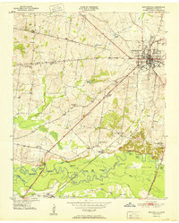
1951 Map of Brownsville
USGS Topo · Published 1951About this map
Brownsville serves as the focal point of this Haywood County landscape in the early 1950s, where the city's residential streets give way to the sprawling Hatchie Bottom. This low-lying drainage basin of the Hatchie River is a complex network of oxbow lakes, including Moon Lake, Swan Lake, and Horseshoe Lake, reflecting a natural riparian environment before modern channelization. The transition from the town's industry and schools, like the County High School, to the rural outskirts is marked by the presence of numerous family-named cemeteries such as Oakwood Cem and Rosenwald Cem.
Find a feature on this map
49 named features on this map. Tap any name to fly to it.
Don’t see what you’re looking for? This feature index may not catch every label — zoom into the map to look around manually.
Map Details
Editions of this 1951 Brownsville Map
3 editions found
Other maps of this area

1950 · Sunnyhill
USGS Topo · 1:24,000

1950 · Brownsville
USGS Topo · 1:24,000

1951 · Brownsville
USGS Topo · 1:24,000

1951 · Sunnyhill
USGS Topo · 1:24,000

1952 · Stanton
USGS Topo · 1:24,000

1952 · Dancyville
USGS Topo · 1:24,000

1952 · Stanton
USGS Topo · 1:62,500

1956 · Blytheville
USGS Topo · 1:250,000

1959 · Blytheville
USGS Topo · 1:250,000

1959 · Hillville
USGS Topo · 1:24,000