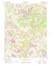
1961 Map of Brownton
USGS Topo · Published 1977About this map
Extensive industrial activity defines the corridor between Harrison and Barbour counties, where the Baltimore And Ohio railroad follows the winding path of Elk Creek and Simpson Creek. This map reveals a landscape heavily shaped by coal production, featuring numerous labeled Mines, Strip Mine operations, and associated infrastructure like the Tipple and Conveyor near Galloway. Amidst this industrial backdrop, local social centers remain prominent, including Green Hill Ch, Trinity Ch, and the rural Brushy Fork Sch.
Find a feature on this map
51 named features on this map. Tap any name to fly to it.
Don’t see what you’re looking for? This feature index may not catch every label — zoom into the map to look around manually.
Map Details
Editions of this 1961 Brownton Map
3 editions found
Other maps of this area

1902 · Clarksburg
USGS Topo · 1:62,500

1902 · Fairmont
USGS Topo · 1:62,500

1904 · Philippi
USGS Topo · 1:62,500

1904 · Weston
USGS Topo · 1:62,500

1910 · Clarksburg
USGS Topo · 1:62,500

1923 · Fairmont
USGS Topo · 1:62,500

1923 · Clarksburg
USGS Topo · 1:62,500

1925 · Clarksburg
USGS Topo · 1:62,500

1925 · Philippi
USGS Topo · 1:62,500

1926 · Fairmont
USGS Topo · 1:62,500