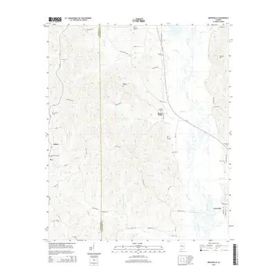
2014 Map of Brownville
USGS Topo · Published 2014About this map
The Sipsey River carves a winding path along the eastern border of this Alabama landscape, marking the transition from the river lowlands to the elevated terrain of Phillips Mtn and Possum Ridge. Small rural settlements are scattered throughout the region, including Moores Bridge in the north and Brownville to the south. The area is dense with family-named landmarks and local burial grounds, such as Spring Hill Cem and Mayfield Cem, reflecting a deeply rooted community history.
Find a feature on this map
55 named features on this map. Tap any name to fly to it.
Don’t see what you’re looking for? This feature index may not catch every label — zoom into the map to look around manually.
Map Details
Editions of this 2014 Brownville Map
This is the sole edition of this map. No revisions or reprints were ever made.
Other maps of this area

1926 · Samantha
USGS Topo · 1:48,000

1928 · Samantha
USGS Topo · 1:62,500

1953 · Birmingham
USGS Topo · 1:250,000

1956 · Birmingham
USGS Topo · 1:250,000

1957 · Birmingham
USGS Topo · 1:250,000

1967 · Brownville
USGS Topo · 1:24,000

1967 · Newtonville
USGS Topo · 1:24,000

1967 · Kennedy
USGS Topo · 1:24,000

1967 · Gordo
USGS Topo · 1:24,000
1967 · Palmetto
USGS Topo · 1:24,000