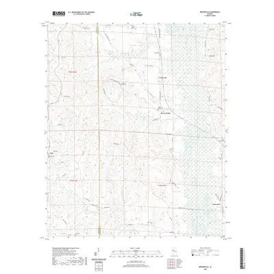
2020 Map of Brownville
USGS Topo · Published 2020About this map
The Sipsey River meanders through this landscape on the border of Pickens and Tuscaloosa Counties, serving as a primary geographic feature for the small communities established along its banks. In the early 21st century, the area remains characterized by rural settlements such as Moores Bridge and Brownville, with an extensive network of family-named cemeteries and roads that speak to generations of local history. Genealogy researchers will find numerous burial sites across the terrain, including New Doublebranches Cem near Zion, as well as Sardis Cem, Winn Cem, and McGee Cem. The topography is defined by significant drainage systems like Thornton Br and Buck Cr, which flow toward the river valley. Landmarks such as Phillips Mtn rise above the bottomlands, while the transition between counties is marked by the presence of Crossroads in the southwest quadrant.
Find a feature on this map
66 named features on this map. Tap any name to fly to it.
Don’t see what you’re looking for? This feature index may not catch every label — zoom into the map to look around manually.
Map Details
Editions of this 2020 Brownville Map
This is the sole edition of this map. No revisions or reprints were ever made.
Other maps of this area

1926 · Samantha
USGS Topo · 1:48,000

1928 · Samantha
USGS Topo · 1:62,500

1953 · Birmingham
USGS Topo · 1:250,000

1956 · Birmingham
USGS Topo · 1:250,000

1957 · Birmingham
USGS Topo · 1:250,000

1967 · Brownville
USGS Topo · 1:24,000

1967 · Newtonville
USGS Topo · 1:24,000

1967 · Kennedy
USGS Topo · 1:24,000

1967 · Gordo
USGS Topo · 1:24,000
1967 · Palmetto
USGS Topo · 1:24,000