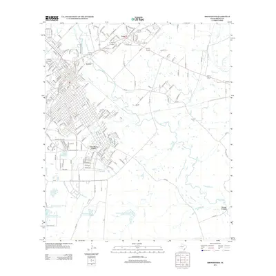
2013 Map of Brownwood
USGS Topo · Published 2013About this map
Pecan Bayou winds through the heart of this Central Texas landscape, acting as the primary drainage for a network of tributaries including Adams Br, Delaware Cr, and Willis Cr. The urban core of Brownwood is represented here by the campus of Howard Payne University and the residential expansion of Woodland Heights. To the north, the separate municipality of Early is established at a major highway junction, while the surrounding rural areas are marked by significant institutional and conservation sites like the US Agricultural Experiment station and multiple flood control structures, including the Soil Conservation Service Site 25 Reservoir. Local history and genealogy are well-preserved through several established burial grounds, most notably Greenleaf Cem near the town center and the more outlying Connell Cem and Beairds Cem. The map further documents the managed water resources of the era, from the Camp Bowie Reservoir to the Country Club Lake.
Find a feature on this map
196 named features on this map. Tap any name to fly to it.
Don’t see what you’re looking for? This feature index may not catch every label — zoom into the map to look around manually.
Map Details
Editions of this 2013 Brownwood Map
This is the sole edition of this map. No revisions or reprints were ever made.
Other maps of this area

1887 · Coleman
USGS Topo · 1:125,000

1889 · Brownwood
USGS Topo · 1:125,000

1889 · Coleman
USGS Topo · 1:125,000

1894 · Brownwood
USGS Topo · 1:125,000

1924 · Brownwood Reservoir Site
USGS Topo · 1:48,000

1925 · Brownwood 3-b
USGS Topo · 1:48,000

1925 · Brownwood 3-d
USGS Topo · 1:48,000

1927 · Grosvenor
USGS Topo · 1:62,500

1928 · Zephyr
USGS Topo · 1:62,500

1950 · Zephyr
USGS Topo · 1:62,500