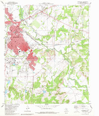
1980 Map of Brownwood
USGS Topo · Published 1980About this map
Brownwood and its neighboring community of Early are defined by the convergence of the Atchison Topeka and Santa Fe railway and the meandering course of Pecan Bayou. The 1980 landscape shows a mix of educational landmarks, such as Howard Payne University and the MacArthur Acad of Freedom, alongside the residential growth of Woodland Heights. To the south, the expansive Camp Bowie Military Reservation dominates the terrain, while the city's civic life is centered around the Courthouse and the Coliseum.
Find a feature on this map
97 named features on this map. Tap any name to fly to it.
Don’t see what you’re looking for? This feature index may not catch every label — zoom into the map to look around manually.
Map Details
Editions of this 1980 Brownwood Map
2 editions found
Other maps of this area

1887 · Coleman
USGS Topo · 1:125,000

1889 · Brownwood
USGS Topo · 1:125,000

1889 · Coleman
USGS Topo · 1:125,000

1894 · Brownwood
USGS Topo · 1:125,000

1924 · Brownwood Reservoir Site
USGS Topo · 1:48,000

1925 · Brownwood 3-b
USGS Topo · 1:48,000

1925 · Brownwood 3-d
USGS Topo · 1:48,000

1927 · Grosvenor
USGS Topo · 1:62,500

1928 · Zephyr
USGS Topo · 1:62,500

1950 · Zephyr
USGS Topo · 1:62,500