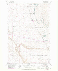
1954 Map of Bruce
USGS Topo · Published 1978About this map
Paradise Flats defines the topographic character of this portion of Adams County, where the agricultural landscape is shaped by the irrigation infrastructure of the East Low Canal. The 1978 photorevisions reflect a mid-century period of development, showing the rail-dependent hamlets of Bruce and Koren along the Bruce Burlington Northern line. The importance of water management in this dry region is evident through features like the Kansas Prairie Siphon and several Levees that guide the flow across the terrain. Rural life and transit are anchored by a grid of named thoroughfares including Foley Road and Cunningham Road, connecting isolated landmarks such as a lone Windmill and the settlement at Billington. A local Quarry and a central Water Tank further indicate the industrial and resource needs of the scattered high-plains communities during the 1950s and 1970s.
Find a feature on this map
20 named features on this map. Tap any name to fly to it.
Don’t see what you’re looking for? This feature index may not catch every label — zoom into the map to look around manually.
Map Details
Editions of this 1954 Bruce Map
2 editions found
Other maps of this area

1916 · Connell
USGS Topo · 1:125,000

1918 · Connell
USGS Topo · 1:125,000

1924 · Othello
USGS Topo · 1:62,500

1925 · Scooteney Lake
USGS Topo · 1:62,500

1951 · Scooteney Lake
USGS Topo · 1:62,500

1953 · Walla Walla
USGS Topo · 1:250,000

1954 · Bruce
USGS Topo · 1:24,000

1954 · Warden
USGS Topo · 1:24,000

1954 · Soda Lake
USGS Topo · 1:24,000

1954 · Othello
USGS Topo · 1:24,000