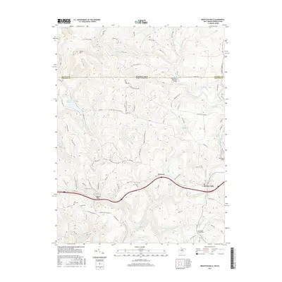
2016 Map of Bruceton Mills
USGS Topo · Published 2016About this map
Bruceton Mills stands as the primary settlement on this topography of the Pennsylvania and West Virginia borderlands, where the Big Sandy Creek corridor dictates the local geography. The landscape is defined by the sharp descent from Devies Mtn toward the water, with the community of Hopewell and the waters of Bruceton Mills Lake situated along the lower elevations. Numerous bridges, such as the West Clifton Mills Truss Bridge and the Barmaster Bridge, demonstrate the vital importance of river crossings for the regional road network.
Find a feature on this map
94 named features on this map. Tap any name to fly to it.
Don’t see what you’re looking for? This feature index may not catch every label — zoom into the map to look around manually.
Map Details
Editions of this 2016 Bruceton Mills Map
This is the sole edition of this map. No revisions or reprints were ever made.
Other maps of this area

1900 · Uniontown
USGS Topo · 1:62,500

1900 · Masontown
USGS Topo · 1:62,500

1902 · Morgantown
USGS Topo · 1:62,500

1903 · Masontown
USGS Topo · 1:62,500

1904 · Bruceton
USGS Topo · 1:62,500

1925 · Morgantown
USGS Topo · 1:62,500

1926 · Bruceton
USGS Topo · 1:62,500

1931 · Uniontown
USGS Topo · 1:62,500

1931 · Masontown
USGS Topo · 1:62,500

1931 · Bruceton Mills
USGS Topo · 1:62,500