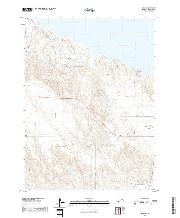
2021 Map of Brule NE
USGS Topo · Published 2021About this map
Lake McConaughy dominates the northern landscape of this Keith County region, where the high plains meet the intricate drainages of the South Platte River valley. The terrain is defined by a series of prominent draws including Ogallala Gulch, Kelly Canyon, and Berry Gulch, which carve through the sandhills toward the shoreline. Recent residential development is evident in the cluster of neighborhoods such as Lakeview Hts, Lakeview Hills 2, and Hidden Canyon Est, reflecting the area's transition toward recreational and suburban use near the water.
Find a feature on this map
34 named features on this map. Tap any name to fly to it.
Don’t see what you’re looking for? This feature index may not catch every label — zoom into the map to look around manually.
Map Details
Editions of this 2021 Brule NE Map
This is the sole edition of this map. No revisions or reprints were ever made.
Other maps of this area

1897 · Ogallala
USGS Topo · 1:125,000

1900 · Ogallala
USGS Topo · 1:125,000

1954 · North Platte
USGS Topo · 1:250,000

1956 · North Platte
USGS Topo · 1:250,000

1957 · North Platte
USGS Topo · 1:250,000
1961 · Brule
USGS Topo · 1:24,000
1961 · Brule SE
USGS Topo · 1:24,000

1967 · North Platte
USGS Topo · 1:250,000

1971 · Martin
USGS Topo · 1:24,000
1971 · Brule NW
USGS Topo · 1:24,000