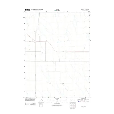
2011 Map of Brule NW
USGS Topo · Published 2011About this map
El-Company Airport serves as a lone aviation landmark in this corner of the Nebraska panhandle, situated amidst a precise grid of rural section roads. The landscape is defined by the intersection of north-south routes like Road W L N and Road W N N with their east-west counterparts, including Road W 150 and Road W 100. This rigid surveying pattern, characteristic of the High Plains, organizes a terrain marked by intermittent drainage patterns and small depressions. In the northwestern corner, Eagle Canyon Rd provides a named deviation from the numeric grid, suggesting local topographic features or historical access points. The sparse distribution of named points highlights the essential role of the section road network in providing access to this agricultural and ranching country north of the South Platte River corridor.
Find a feature on this map
16 named features on this map. Tap any name to fly to it.
Don’t see what you’re looking for? This feature index may not catch every label — zoom into the map to look around manually.
Map Details
Editions of this 2011 Brule NW Map
This is the sole edition of this map. No revisions or reprints were ever made.
Other maps of this area

1897 · Ogallala
USGS Topo · 1:125,000

1900 · Chappell
USGS Topo · 1:125,000

1900 · Ogallala
USGS Topo · 1:125,000

1954 · Scottsbluff
USGS Topo · 1:250,000

1954 · North Platte
USGS Topo · 1:250,000

1956 · North Platte
USGS Topo · 1:250,000

1957 · North Platte
USGS Topo · 1:250,000

1958 · Scottsbluff
USGS Topo · 1:250,000

1961 · Big Springs
USGS Topo · 1:24,000
1961 · Brule
USGS Topo · 1:24,000